Hut-to-hut hiking in the Dolomites
This item appears on page 23 of the October 2020 issue.
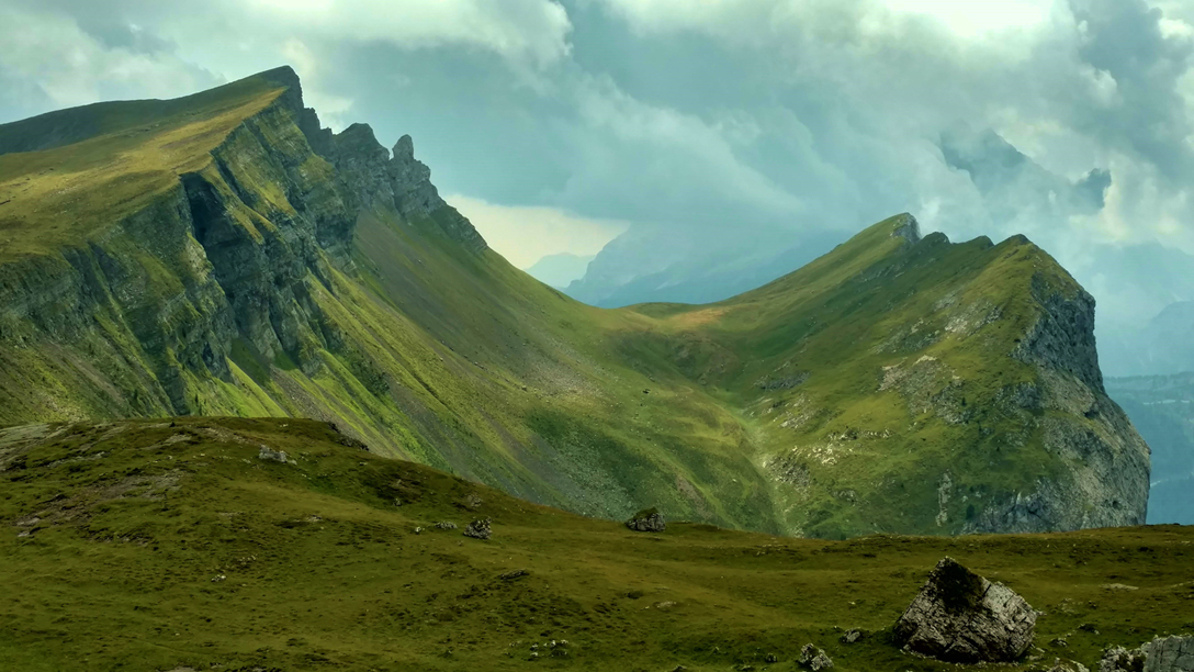
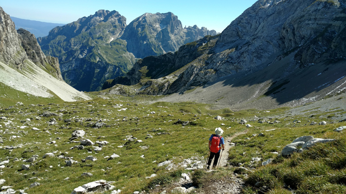
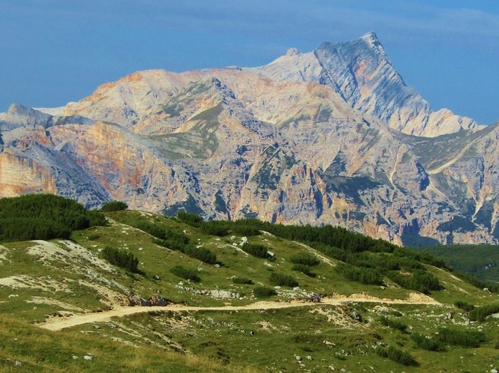
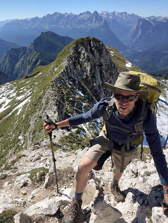
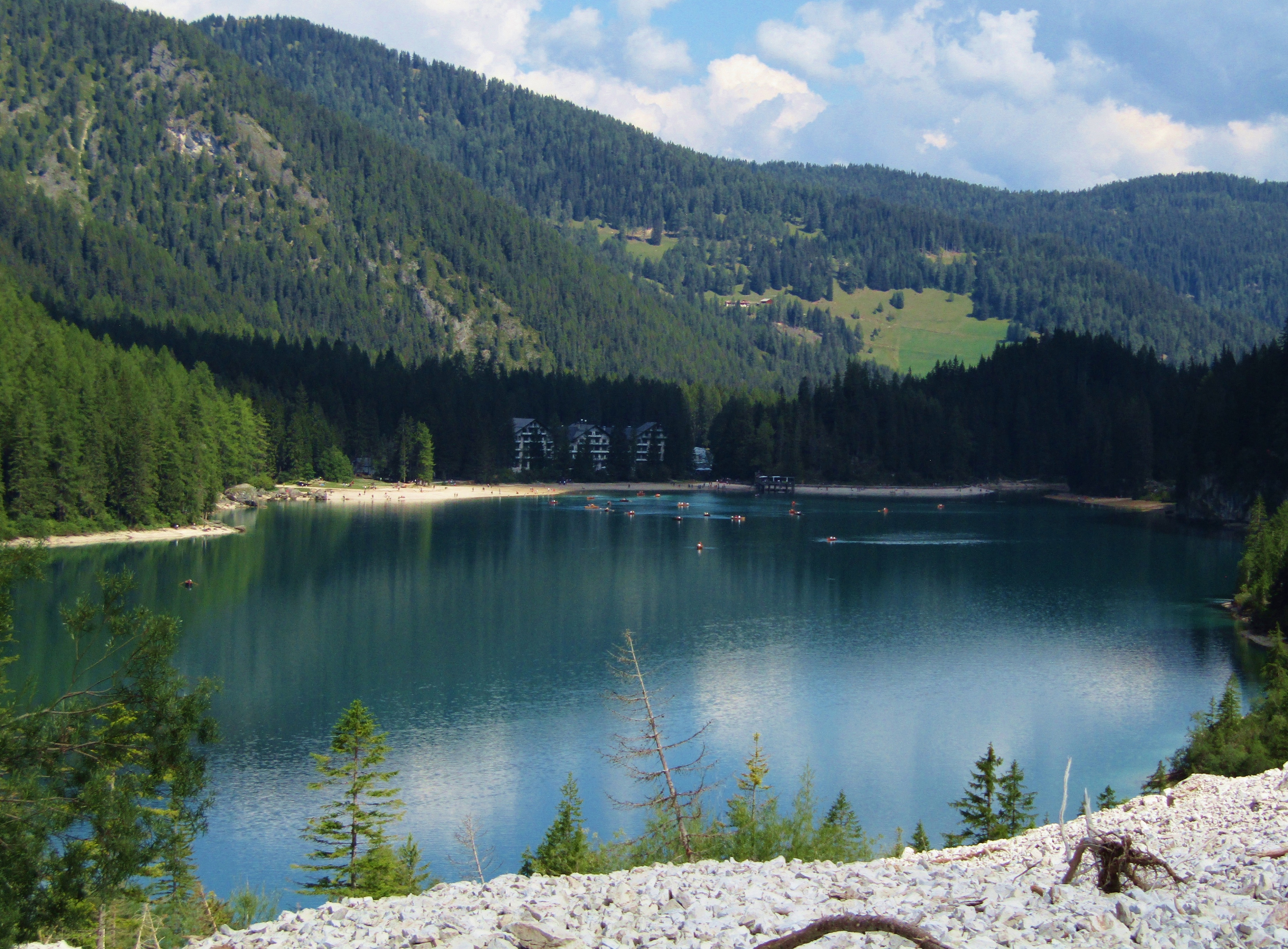
My husband, Steve Mullen, and I enjoy long-distance hikes. One of our most unforgettable hikes was one we took through the Dolomites in northern Italy in August 2018. It involved walking along the 75-mile-long Alta Via 1 (AV1), which wends its way through spectacular jagged mountains, lush green valleys and no towns, though several roads are crossed.
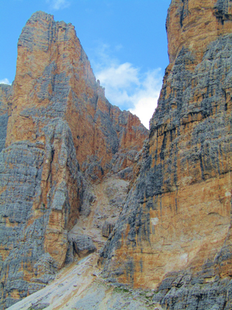
The hut-to-hut hike on the AV1 is one of eight roughly parallel Alta Via routes through the Dolomites range, a UNESCO World Heritage Site.
Although the AV1 is generally regarded as being the easiest route, 3,000-foot elevation gains and losses in a day’s walking are common. A couple of days involve airy climbs, and though it’s easy to avoid via ferrata* routes, some short sections have cables through mildly exposed sections for safety.
After flying into Venice and enjoying a few days there, Steve and I took a bus (found through a Google search) to the beautiful mountain town of Cortina d’Ampezzo, which served as a convenient base camp before we started our hike on Aug. 20.
ALTA VIA 1 — Most people start at the trailhead at Lago di Braies, near the town of Dobbiaco, and head south to the end, near Belluno. Reaching a maximum of 9,029 feet, the trail’s elevation is not high compared to other classic trails, so altitude sickness is not a concern for any but the most sensitive individuals. The trail’s total accumulated elevation gain, however, is significant: 21,833 feet.
We used the Cicerone guidebook “Trekking in the Dolomites: Alta Via 1 and Alta Via 2 with Alta Via routes 3-6 in outline,” which divides the AV1 into 11 stages. We did the trek in nine days, but there are many variations of the route.
During World War I, the boundary between Italy and the Austro-Hungarian Empire ran through the Dolomites, leaving behind a fascinating collection of tunnels, foxholes and artifacts along the trail.
Due to shifting borders at different times, German, Italian and Ladin are all spoken in the region, and interpretive signs are often presented in those three languages. English is spoken by many (but not all) people in hotels, restaurants, shops and rifugios (hikers’ shelters, usually mountain huts or hotels).
WHEN TO GO — Summer is hiking season, but, as in many Alpine environments, snowfall may occur. Mid-July to mid-September is ideal, as snow is likely to linger into early July. Snowstorms do sometimes occur in the summer but with little accumulation. We had 3 to 5 inches of snow one night.
RESERVATIONS — For our trip, Steve made reservations in January and we still didn’t get everything we wanted. We didn’t care that much and were satisfied with two private rooms reserved out of 10 nights. There must have been cancellations because we ended up getting more private rooms than that.
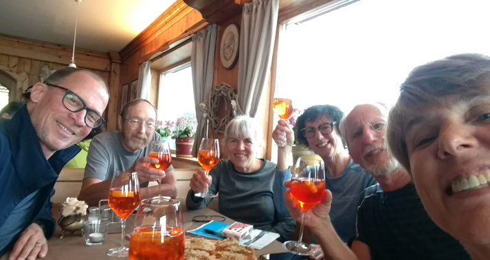
Four friends who decided to join us later couldn’t get reservations at all for the first few days, so they joined us the afternoon of Day 3 and did a 5-day hike.
Depending on your budget and style, you can make reservations on your own using the list at the Alta Via 1 Dolomites website (www.altavia1dolomiti.com/rifugi), or you can use a tour company.
We chose to do a self-guided tour, with Macs Adventure (www.macsadventure.com/us) planning our route, making reservations and providing us with custom trail information. We hiked independently with our friends and never met anyone from the company, although they had provided us with a guidebook and topographic maps.
With half-board (bed plus breakfast and dinner daily), our tour price of $1,825 per person included a mix of dorms and private rooms. A check in January 2020 showed the price for the dorms-only option starting at $1,550.
Our reservations included a Cicerone Press guidebook and a pamphlet from Macs, with supplemental information for each day’s hike. These were mailed to us in the US before our trip. Our US-based contact with Macs was very responsive during the planning process.
We had only one glitch. After hiking all day, we arrived at a rifugio in pouring rain only to learn that they had no record of our reservation! The host made room to accommodate us. Macs Adventure is well known there, so no payment was expected; the company worked it out later. Macs was apologetic and refunded our night’s stay.
If you decide to make your own reservations, you can also find rifugios listed in the Cicerone guidebook. Email is the best way to reach proprietors, but reports of lengthy delays in response are common. It’s helpful to have a working knowledge of Italian, but it’s not required.
Prices for lodging at rifugios ranged from about $50 to $250 per night, depending on amenities and whether the room was private.
ITINERARY — Pre-hike, Steve and I stayed three nights in Cortina d’Ampezzo, doing day hikes and stocking up on last-minute food supplies, then we walked the entire length of the AV1. (Distances given below are approximate.)
Day 1: From Cortina d’Ampezzo, we took a bus to Dobbiaco, then another to Lago di Braies, from which we walked 6.2 miles in 4 hours to Rifugio Biella.
Day 2: Rifugio Biella to Rifugio Lavarella — 6.2 miles in 4 hours.
Day 3: Rifugio Lavarella to Rifugio Lagazuoi — 7.5 miles in 6 hours.
Day 4: Rifugio Lagazuoi to Rifugio Averau — 9.3 miles in 5 hours.
Day 5: Rifugio Averau to Rifugio Citta di Fiume — 9.3 miles in 5 hours.
Day 6: Rifugio Citta Di Fiume to Rifugio Sonino al Coldai — 5.6 miles in 4 hours.
Day 7: Rifugio Sonino al Coldai to Rifugio San Sebastiano — we expected to walk 11.1 miles in 10 hours, but due to 5 inches of snow at night, we had to hike to a road and call a car service for a driver to take us to the next rifugio.
Day 8: Rifugio San Sebastiano to Rifugio Pian de Fontana — 9.9 miles in 7 hours.
Day 9: Rifugio Pian de Fontana to the end — 8.7 miles in 4 hours, followed by a bus to Belluno. After staying in Belluno for two nights, we took the train to Venice and continued traveling for another week or so.
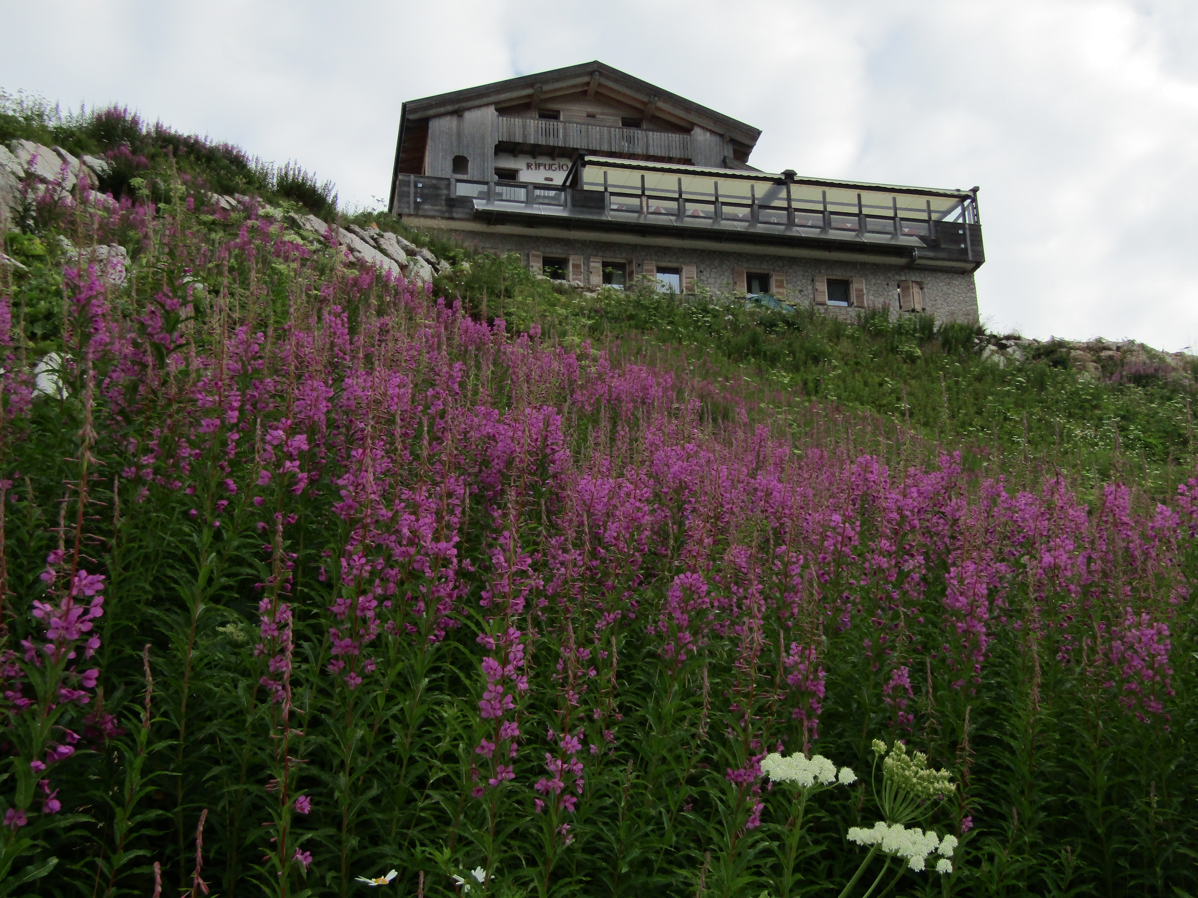
RIFUGIOS — We enjoyed and appreciated all the rifugios we stayed in, but they varied a lot.
The older, more rustic rifugios were like a slice of history. Some were Italian Alpine Club huts, which tended to be small, with cramped dorm spaces. Rows of double bunks sometimes had only enough space between them for one person to walk through, and there might be only one or two token-operated showers for varying minutes that served many people in succession.
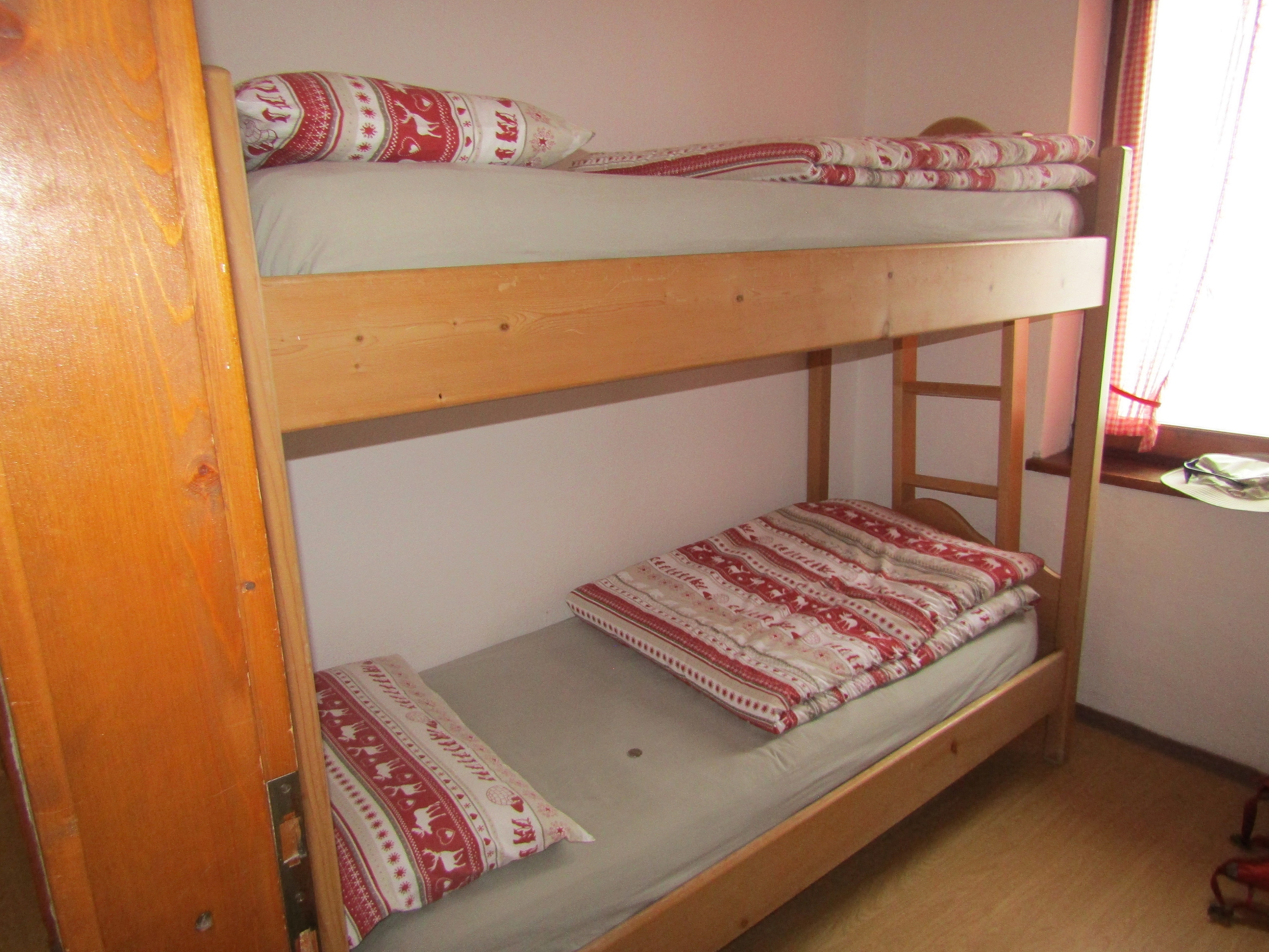
A small dorm room might mean that access to upper bunks was possible only with an upright ladder versus an easier-angled ladder. Menu choices and breakfast spreads tended to be limited, though filling food was always available.
Some huts were pure luxury. These cost a lot more per night and had more spacious dorms, multiple showers, and amenities such as boot dryers. One even had a sauna. Multiple menu options (including extensive wine and beer) were a treat.
Our favorite rifugios were Lavarella and Averau, for the upscale ambience, excellent food and friendly service. Lagazuoi was insanely busy, and the staff seemed frazzled. The people at Pian de Fontana were nice and welcoming, and the setting on the side of a mountain was stunning. Coldai had the most unique perch on a high mountain saddle.
Backpacking (wild camping) was not observed among individuals, and I understand it is not legal in Italy.
FOOD — Breakfasts in the rifugios were served buffet style. Eggs (soft boiled) were rare, while muesli, yogurt, bread and pastries were common, along with coffee, tea and juice. Sometimes sliced cheese and ham were available.
Lunch was not included and had to be ordered the night before. We found the offerings to be good quality but monotonous — a large roll with thin slices of Speck (a cured meat similar to prosciutto but smoked) and cheese and nothing else, not even condiments.
Toward the end, I requested a whole tomato (Roma tomatoes hold up well in a sack lunch), which added a welcome touch to our sandwiches. An apple was usually included too.
The third component was a sweet treat, often Loacker wafers.
Dinner varied the most. Some rifugios had fixed menus, but most offered two or three choices. The quality was consistently good, with hearty portions — green salad, pasta course, main course and dessert. Wine and beer were always available for purchase. The food was generally meat-heavy; some offered vegetarian main courses, but many did not.
We started the trip with all the snacks we’d need for the entire trip, mostly brought from home. Ten days of snacks add up!
Check Customs requirements before deciding what to take. I’ve found that, in most cases, when traveling to other countries, it is safest to take foods in their original packaging and leave the homemade foods behind.
NAVIGATION — The trail was well signed, but be aware that signposts list times, not distances. A sign with “2h30m” means it will take the average hiker 2½ hours to reach the next milestone. We found that it was pretty accurate for our pace. The estimates are consistent, so if you’re faster or slower than the times indicated, you can expect that to carry through the whole trip.
Our topographic maps were helpful for seeing the route and the surrounding terrain. If you purchase the Tabacco maps (each in both Italian and German), you’ll need three (available on Amazon.com) to cover the entire trail: Tabacco 031 “Dolomiti di Braies” (Stages 1-2); Tabacco 03 “Cortina d’Ampezzo e Dolomiti Ampezzane” (Stages 2-5), and Tabacco 025 “Dolomiti di Zoldo, Cadorine e Agordine” (Stages 5-11).
It takes a bit of planning, a reasonable amount of fitness and a lot of walking, but, for dedicated hikers, the unique experience of hiking the Alta Via 1 is worth it!
INGA AKSAMIT
Kenwood, CA
*Via ferrata gear includes a helmet, climbing harness, lanyard and carabiners that can be attached to, for example, cables bolted into the rock. If you book through a tour company, they’ll likely provide route cards that either avoid via ferrata routes or make it clear where they are and how to avoid them, if desired. The Tabacco maps we purchased used plus signs (+++++) to mark these sections. — Inga