Hiking the southwest coast of England
by J. Norvill Jones, Alexandria, VA
England is a land of walkers and paths to accommodate them. And none surpasses the splendor of England’s longest footpath, the 630-mile South West Coast Path, which runs from Minehead on the Atlantic around Land’s End to Poole in the English Channel. In May ’05, I had the pleasure of hiking 120 miles of this path.
South West Coast Path
More than a decade ago, an English friend, knowing of my interest in hiking, gave me a book about the South West Coast Path. Years later, looking for an outdoor activity for spring, I decided to follow my friend’s recommendation.
I contacted the South West Coast Path Association in England, the primary source for information on the path, and obtained their excellent guidebook. With that, I laid out an itinerary that would take me down the Atlantic coast through North Devon and Cornwall and around Land’s End, ending at Penzance (of Gilbert and Sullivan fame).
Each segment of the path is officially graded for difficulty, from “easy” to “severe.” My plan to cover about 15 miles a day proved to be a bit too ambitious, as the area I chose to hike turned out to be one of the toughest on the entire path. I averaged only 10 miles a day, but short hops on local buses permitted me to make up the 50 or so miles missing from my original plan and got me to Penzance on schedule.
Starting out
To reach my starting point, two trains and a bus ride got me from Heathrow Airport in London to the seaside village of Westward Ho!, where I began my hike, or “walk” as the English would say. Westward Ho!, a Devon town as undistinguished as the 19th-century novel for which it was named, is said to be the only town in England which ends with an exclamation mark.
After a night’s rest, my journey began somewhat inauspiciously when, while leaving my B&B the next morning, I fell flat on my backpack on a slippery slate walk. Notwithstanding intermittent showers, which became a routine occurrence, my day got better.
In a small copse I found a dead sapling which, with some surgery, made a fine walking stick. It proved to be an essential companion in navigating the steep ups and downs that marked the coastal path. Over time, I came to think of it fondly as my partner, calling it Tonto after the Lone Ranger’s sidekick.
The terrain
Spectacular scenery, thick layers of history, friendly people, plenty of spots for food and lodging, and convenient bus and taxi service combine to make the South West Coast Path a hiker’s ideal. Vestiges of history, from prehistoric to modern, lie throughout the region, ranging from ruins of Celtic villages to the more recent past in the form of abandoned tin and copper mines.
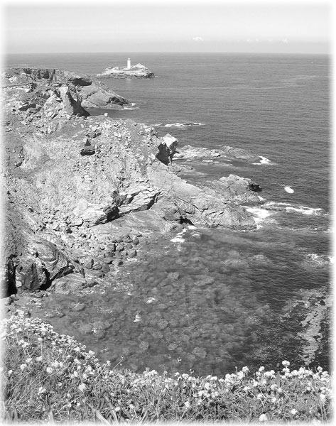
Essentially, the southwest coast of England consists of a combination of broad tidal estuaries and high cliffs, indented by streams which, over eons, have carved narrow, steep sloped valleys usually ending in sandy coves.
The coast is beautiful in any season but is at its finest in springtime. In May, yellow gorse, daisies, foxglove, bluebells, thrift and a multitude of other wildflowers are rampant.
On the cliff tops, the path skirts carefully husbanded farms dotted with curious sheep and cattle in pastures separated by drywall flagstone hedges in herringbone patterns. Stiles and “kissing gates” allow one to cross hedgerows and the occasional fence.
It is a heady experience to hike along only yards from a cliff face that plummets hundreds of feet to a pounding surf, but one must pay a price for the pleasures of cliff-top walking. The steep descents into and ascents out of the many valleys make for tough hiking, yet anticipating what lies at the top is a special treat of coastal hiking. Once the top is reached, each view is a revelation and always worth the climb.
Accommodations
There were surprisingly few distance hikers on the path, though this was the finest time of the year to be there. Near towns, I would encounter local hikers out for short walks, but on an average day I seldom met more than two or three others on long walks. I never saw another American doing a distance hike.
I did my planning using “The South West Coast Path, 2005 Guide” and segment maps of the path published by the South West Coast Path Association (Bowker House, Lee Mill Bridge, Ivybridge, Debon PL21 9EF, England; www.swcp.org.uk).
In addition to a segment-by-segment description of the path, the guidebook contains details for lodging and transportation plus other useful information for planning a hike. The 2006 guide is available for purchase on their website.
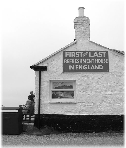
The logistics were simple. Modernized versions of old fishing and mining villages offered plenty of opportunities for refreshment or overnight stays. All of my belongings were carried in a day pack, which never weighed more than 20 pounds.
I stayed in B&Bs (where I had made reservations in advance) and ate in local pubs. For lodging, you get what you pay for — at the high end, $65 gets you an excellent room with a private shower; at the bottom of the scale, $35 affords little more than a day bed with facilities down the hall. My main complaint about B&Bs was the omnipresent duvet bed covers which, when on, were too hot and, when off, left me too cold.
Pub meals were cheap — $10 or so for fish and chips — but heavy on the grease. Healthy pub food is an oxymoron. After some experimentation, I settled on steak and ale or kidney pie as my standard dinner.
For lunch, I would eat something from my backpack, perhaps a piece of fruit and a couple of energy bars bought the night before in a local store.
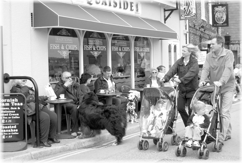
Food quality aside, I always enjoyed people-watching in pubs. I recall one scene in a noisy pub in Portreath where six older men and women were playing cards at an oval table, with two small dogs stretched out underneath ignoring the hubbub around them. Periodically, an owner would pick up his dog and give it a treat and a pat. Talk about the good life! Those dogs had it.
Wind, rain, sun and sand
During my visit, the weather was fickle. Rain marked the beginning and final days of my hike, with fast-changing periods of sun and scudding clouds the rule for other days. I wore a rain jacket every day not so much to ward off rain but as a windbreaker. Gusts coming over the cliff face were often so strong that I had to use my hiking stick to keep my balance.
The English have a special affection for the sea, and they flock to beaches under conditions that Americans would find intolerable. Cornwall alone has some 175 officially recognized beaches, ranging in size from small, isolated coves to the multimile beaches at touristy Newquay and St. Ives. High tides and gentle slopes mean wide beaches and a long walk to the water when the tide is out and a long scramble back when the tide comes in.
A standard item for a family outing on a Cornwall beach is a long swatch of plastic on stakes to keep out blowing sand. Many beaches are beacons for surfers who, rain or shine, were out in their wetsuits.
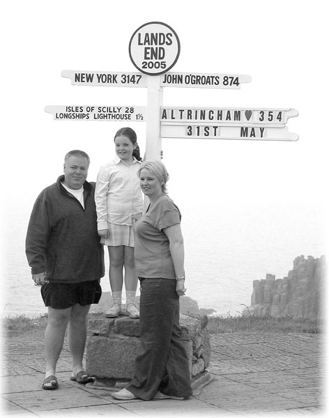
Declaring victory
After 110 miles in rain and fog, I rounded Land’s End and met the English Channel. Though a day’s hike shy of Penzance, I felt that I had achieved my goal.
The scenery in this area was described in the guidebook as some of the best on the entire path, but through the rain and murk I could see little.
My next B&B was in tiny Porthcurno, the home of the first transatlantic cable, which I reached in a downpour. Two more days of rain were forecast, the B&B owner said. After mulling over the situation in a hot bath, I decided to declare victory and go home.
The next morning I caught the local bus to Penzance, then two trains and yet another bus, which got me to Heathrow by the evening.
As a 75-year-old who has hiked in much of the world, I rate the South West Coast Path as one of my most scenic hikes. Perhaps in my younger days I would have said that hiking it was a piece of cake. But the decades have taken their toll and, for difficulty, I now rank it second only to the Brooks Range of Alaska.
If you like to walk, try it sometime. You have 630 miles of lovely scenery to choose from and you will not regret it.